
Dunbar Neighbor Evidence by Block
Public records describe parcels, ownership, registration, projects, and civic activity. They do not describe a social relationship. Start with the source that fits the question, then mark what it proves and what it leaves open. The distinction matters on a Dunbar block because owner, occupant, voter, contractor, and meeting participant are different roles.
| Official or local source | Block evidence available | Access route |
|---|---|---|
| Kanawha assessor GIS | Parcel shapes, adjoining parcels, and map context; visible pop-up fields must be checked live | Free web viewer; assessor office fallback |
| Kanawha property search | Street address, current owner, mailing address, map and parcel, deed book and page | Free address search; real-estate desk |
| West Virginia voter records | Individual status and districts by name and birth date; statutory list inspection has limits | Online person lookup, county counter, or state request form |
| Dunbar permits and vacant-building files | Project address, owner or entity, work, contractor, status, dates, and parcel fields | Building Inspector or City Clerk request |
| Dunbar Neighborhood Watch | Public meeting and civic contact, not a roster of homes or members | City page; verify the current schedule |
For immediate neighbors, use the GIS and assessor pair. The voter route is person-first, not block-first. City files can add a dated event at one address. The watch page is a community lead only. No official Dunbar HOA or neighborhood-association umbrella directory was found, so a missing roster should not be filled with guessed names.
Map Dunbar Neighbors Parcel by Parcel
The Kanawha County Assessor GIS viewer is the map route, but its live controls and parcel pop-ups did not render in the research capture. Do not assume it has a buffer, export, flood, or zoning tool. Use only what the live screen visibly offers. The assessor says its mapping comes from deeds and surveys for assessment work and is not itself a survey.
The verified block process is:
- Search the starting address as a situs, the physical parcel location, in the assessor property search.
- Copy its map and parcel ID plus the legal description before opening the GIS view.
- Click each polygon that touches the starting lot. Record only the parcel ID, address, or owner fields that appear.
- Run every adjoining parcel through the assessor and keep its Street Address separate from its Mailing Address.
- Compare map numbers and legal descriptions. Follow deed references only when a shared grantor or subdivision question matters.
This produces a bounded set of properties around one point. It does not prove that each owner resides there or knows the people next door. The statewide assessment search offers a Prior Ownership mode, while the county-linked land index and the County Clerk record room at 304-357-0240 provide the deed route. Verify every grantor, grantee, book, page, and legal description before comparing nearby chains. For a full named-street sweep, switch to the Dunbar street directory process instead of extending the radius without a clear limit.
Read Dunbar Neighbor Parcel Cards
The Kanawha property search accepts Owner Name, Parcel Address, Account Number, District, a four-part Map/Parcel value, Property Type, Legal Description, and Deed Book/Page. Use Parcel Address for nearby lots. Owner names are entered LAST NAME FIRST NAME without commas when a name search is needed.
A returned card can expose Street Address, Current Owner, Mailing Address, Deed Book/Page, Sales History, Assessment Record, and Land Map/Parcel. It may also link building, map-card, and tax-data views. These labels make a useful inventory, but the research did not capture a populated Dunbar sample. Never invent a value or claim that every parcel ID returns a card.
- Situs address
- The physical location of the parcel. Use it to place a lot on the block.
- Mailing address
- The destination used for owner correspondence. It may be a post office box or another location.
- Parcel
- A mapped unit of assessed land identified by county map and parcel numbers.
- Plat
- A recorded map that can show lots, blocks, streets, and subdivision layout.
Note: A homestead or mailing clue still needs corroboration and should never be converted into a public claim about a private household.
Check Dunbar Neighbor Voter Clues
West Virginia's Am I Registered to Vote lookup requires first name, last name, and date of birth. Its result can show registration status, party, districts, and polling place. The state says data refreshes nightly, with a maintenance period from midnight to 2 a.m. A result is a status snapshot. It is not a public street roster and does not prove current occupancy.
WV Code section 3-2-30 permits inspection of active, inactive, rejected, and canceled registration records, subject to exclusions and use rules. Phone, email, Social Security number, driver-license data, and state-ID data are excluded. The current request form can provide paid lists with residence address and county and offers municipal or precinct selections, but it also sets fees and bars solicitation, advertising, and resale.
All access channels remain distinct. Check one voter online. Call Kanawha voter registration at 304-357-0110 or visit the county clerk route at 409 Virginia Street East for counter access. State election help is available by phone or email. Use the formal list request only when its defined data and lawful purpose fit the inquiry. FOIA does not erase the voter statute's limits.
Dunbar Neighborhood Watch Needs Verification
The official Dunbar Neighborhood Watch page is the only current city-hosted civic association lead found in the research. It announces a public meeting, but it does not publish members, household addresses, or an association roster. The dedicated page and city home disagree about the time and frequency, so contact the city before attending instead of merging the two schedules.
The source image below preserves the watch page as a civic contact point. It should not be read as a directory of Dunbar neighbors.
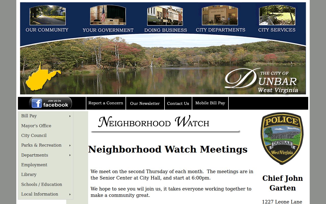
One page reports monthly meetings on the second Thursday at 6 p.m.; the city home reports alternating months at 6:30 p.m. That mismatch is a good reminder to date every community source and verify live details.
Dunbar Neighborhood Watch
Dunbar Senior Center at City Hall
Public meeting lead; no member directory
Dunbar City Clerk
P.O. Box 483
Dunbar, WV 25064
304-766-0218
Municipal records and meeting-record requests
Dunbar Block Records at City Hall
Address-linked city files may explain work or vacancy on a nearby parcel. Dunbar's building form records Property Owner, Property Address, work type, description, architect or engineer, contractor, subcontractor, cost, and requested completion time. The city says construction, additions, and structural alterations require a permit, and a permit normally expires after six months unless another term is noted.
The vacant-building form adds the filing date, address, tax map and parcel, vacancy or utility status, owner or entity, local property agent, and signatures. Neither file set has a verified public web search. Contact the Building Inspector at 304-766-0217 extension 7 or submit a specific request to the Clerk. Ask for a street address, narrow date range, and record type, not a custom profile of people on the block.
These documents show a role tied to a project. A contractor, local agent, or entity representative is not automatically a resident. Keep that role label with the name.
Compare Dunbar Neighbor Source Types
Official records and commercial neighbor-search products are built for different purposes. An official custodian explains its record, fields, and correction route. A commercial compilation may combine old sources without making the date or record role clear. Use the category only as a lead, and return to the named public office before drawing a conclusion.
| Question | Official record route | Commercial compilation |
|---|---|---|
| Why the name appears | Defined role such as owner, voter, permit applicant, or deed party | Role can be blended or unclear |
| Date and geography | Record date, county, parcel, district, or file reference can be retained | Update date and source boundary may be hard to trace |
| Correction | Assessor, clerk, voter office, or city custodian handles its own record | Separate correction process may not update the public source |
| Best use | Verify the precise fact the record was made to document | Generate a lead that still needs official confirmation |
Free official portals can also change. Save the URL, query, result date, and parcel or file number so another person can repeat the search.
Dunbar Geography Changes the Block
Dunbar city, West Dunbar Census designated place, Kanawha County, and the 25064 postal label are separate geographic layers. A record may use a Charleston-area directory, a Dunbar mailing label, or a county parcel while Census treats the place boundary differently. A ZIP code groups mail delivery. It does not draw parcel lines or prove that a person occupies an address.
The September 1933 Dunbar Sanborn map set adds nine sheets of physical context. It can show an earlier street layout or building footprint, but it carries no ordinary resident list. Use a historical map to explain why the block looks different, then use a dated directory, census schedule, or deed for names. Modern GIS adjacency and historic map proximity also do not prove a personal connection.
Protect Dunbar Neighbors' Privacy
A parcel owner is not a full household, and a voter result is not permission to expose protected details. West Virginia FOIA preserves privacy and law-enforcement exemptions. Court rules limit sealed, juvenile, adoption, expunged, and confidential family material. Utility and delivery customer data were not identified as open block directories. Ask for a specific existing public record and accept a lawful redaction.
The West Virginia Address Confidentiality Program gives qualifying survivors a substitute address and mail forwarding. An apparent address gap may therefore be a safety measure. Never attempt to connect that substitute address to a physical location. Corrections should go to the office that keeps the record: Assessor for a parcel card, County Clerk for an index, voter office for registration, and City Hall for municipal files.
Lawful use. Use neighbor records for civic curiosity, reconnecting, or personal safety awareness. Never use them to follow, threaten, intimidate, or repeatedly monitor anyone.